All Articles
What can Orca do?
July 25, 2025 • 8 min read
How Tablet Navigation Replaces Traditional Chartplotters
This article was originally written by Stephan Boden in German and published in Segelreporter on May 6th, 2025. The translation and following publication have been approved by the original author.
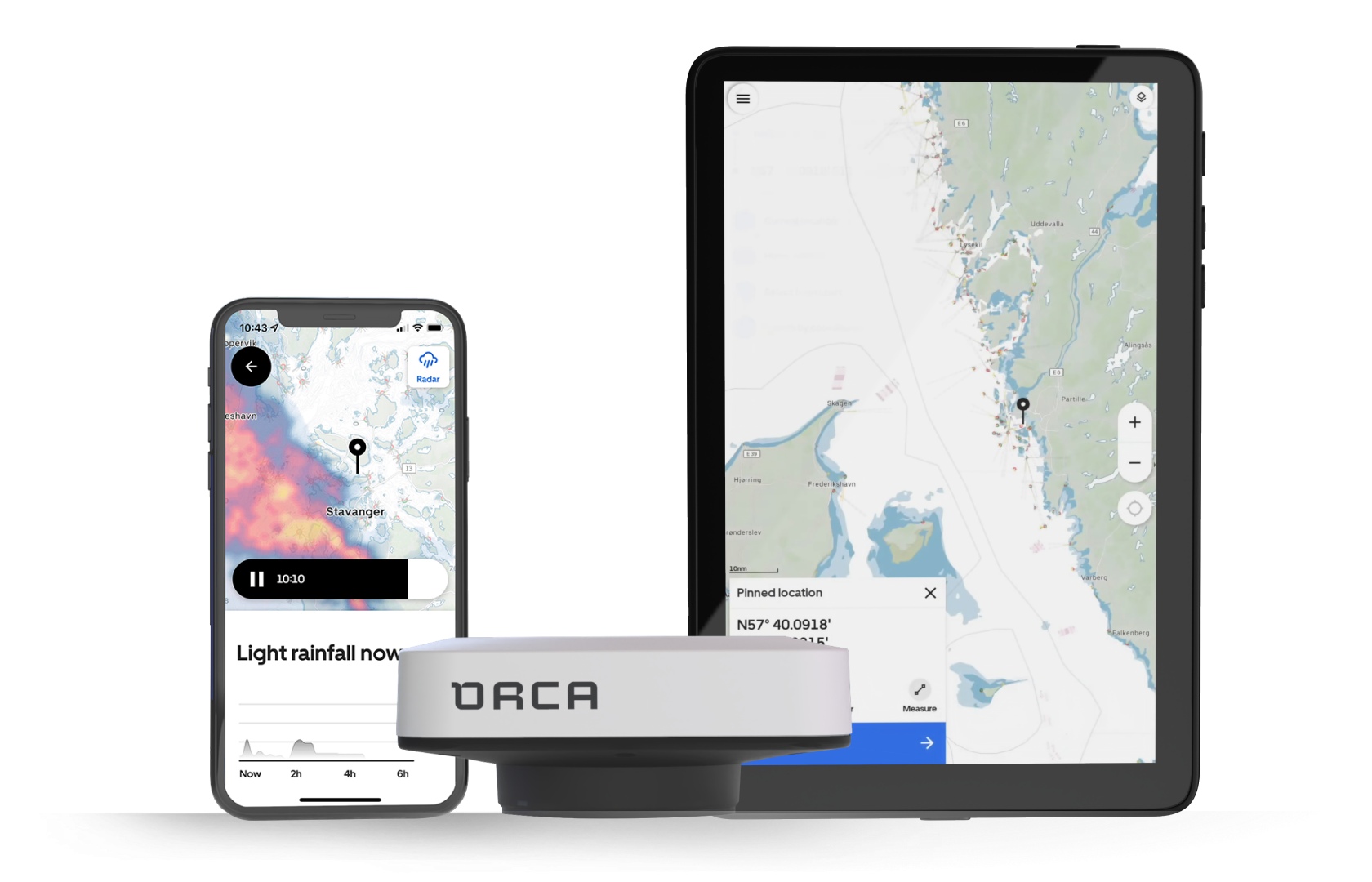
Orca has completely reinvented the concept of navigation via app and mobile device. In addition to the app, which also includes features like weather routing, the Norwegian company offers a purpose-built tablet and an external GPS receiver with a compass, which can be fully integrated into an existing onboard system.
Navigation via mobile apps has been evolving for years. While the early entries came with rudimentary features, over the past few years, new features have been added, such as automatic route planning or integration with existing systems like AIS. However, these developments have always been limited to the software side of apps. For hardware, the user had to take care of it themselves, often faced with a difficult decision. With all the negative aspects. This often led to uncertainty.
The Norwegian company Orca Technologies takes a different approach than all other providers of navigation apps: Orca offers both the software and the corresponding hardware. The basis of the Orca App is that it can be expanded as needed – even to full integration into existing systems, transducers, and sensors. The three Orca co-founders – Amir, Jorge, and Kristian – had already been working in marine electronics for several years when they encountered a seemingly simple question they couldn’t answer:
“Why do over 70% of boaters, despite having navigation systems, still rely on mobile apps to plan and execute their trips? What do these apps offer that built-in chartplotters and multifunction displays cannot?”
In 2020, they went in search of answers – and the response from the community was clear: Marine electronics seemed outdated. The available systems were complicated, slow, disconnected, and reminded them more of car navigation devices from the early 2000s than of modern technology.
Mobile apps offered a better user experience, but they had their weaknesses: They were running on devices not meant for maritime use, which overheated easily and required constant charging. Orca's answer was a system that makes it easy for the user to get started: Through an affordable and powerful app, which can be expanded with additional, tailored hardware into a complete marine navigation system.
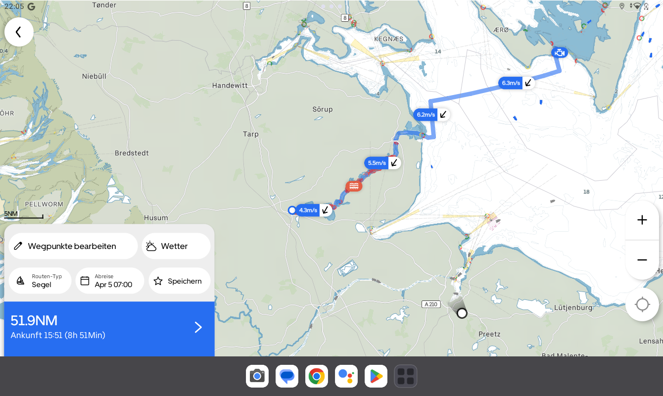
Clear chart view, dedicated sail routing. Photo: Screenshot Orca App
Not only has this new combination of app and corresponding devices led to the Orca system receiving praise on the docks recently, but also the continuous development and partnerships. For example, in the basic app, AIS data from the MarineTraffic is displayed, showing ship traffic even without AIS, only requiring an internet or mobile connection. Orca seems to bring all relevant players on board. For the user, this means fewer things to worry about, because everything is available and from a single source.
So what can Orca do? To illustrate that, it’s worth taking a look at the individual components.
The Orca App
The Orca navigation app impresses right away with a clean design and intuitive usability. Within just a few minutes, all questions are answered. The map image is clear and easy to read; a night mode is available in glare-free red. The app receives its chart data from official providers such as the German Federal Maritime and Hydrographic Agency (BSH) or, in Denmark from Geodatastyrelsen.
Nautical signs, water depths, and relevant chart content are clearly shown, and even the name of lights is included in the standard display. Marinas and harbors are shown with icons; when clicked, they reveal info and data about the docks. This information comes from partner Navily and includes popular anchorages. Even AIS ship traffic is shown on the sea chart.
However, only as long as a mobile connection exists—e.g., along the coast or via satellite internet installed on board. Orca can also integrate data from partnerships—in this case, through a collaboration with MarineTraffic.
The app can be downloaded and tested for free in the App Store and Google Play Store.
Weather Routing Tailored for Sailboats
The highlight for sailors: Weather and wind data, wave heights, tides, weather radar, and other relevant info from regional weather services are included in the app. If the user creates an automatic route in the app and selects “sailboat” as the vessel type, the app performs full weather routing, including tacking.
Wind forecasts are displayed along the route. It works quickly and is surprisingly realistic. If the weather changes significantly, the app issues a warning.
Even the boat’s performance is taken into account. For common vessel types, the app can assign suitable polar data from a database, which then flows into the routing. The configuration options are extensive, enabling the most realistic route planning possible.
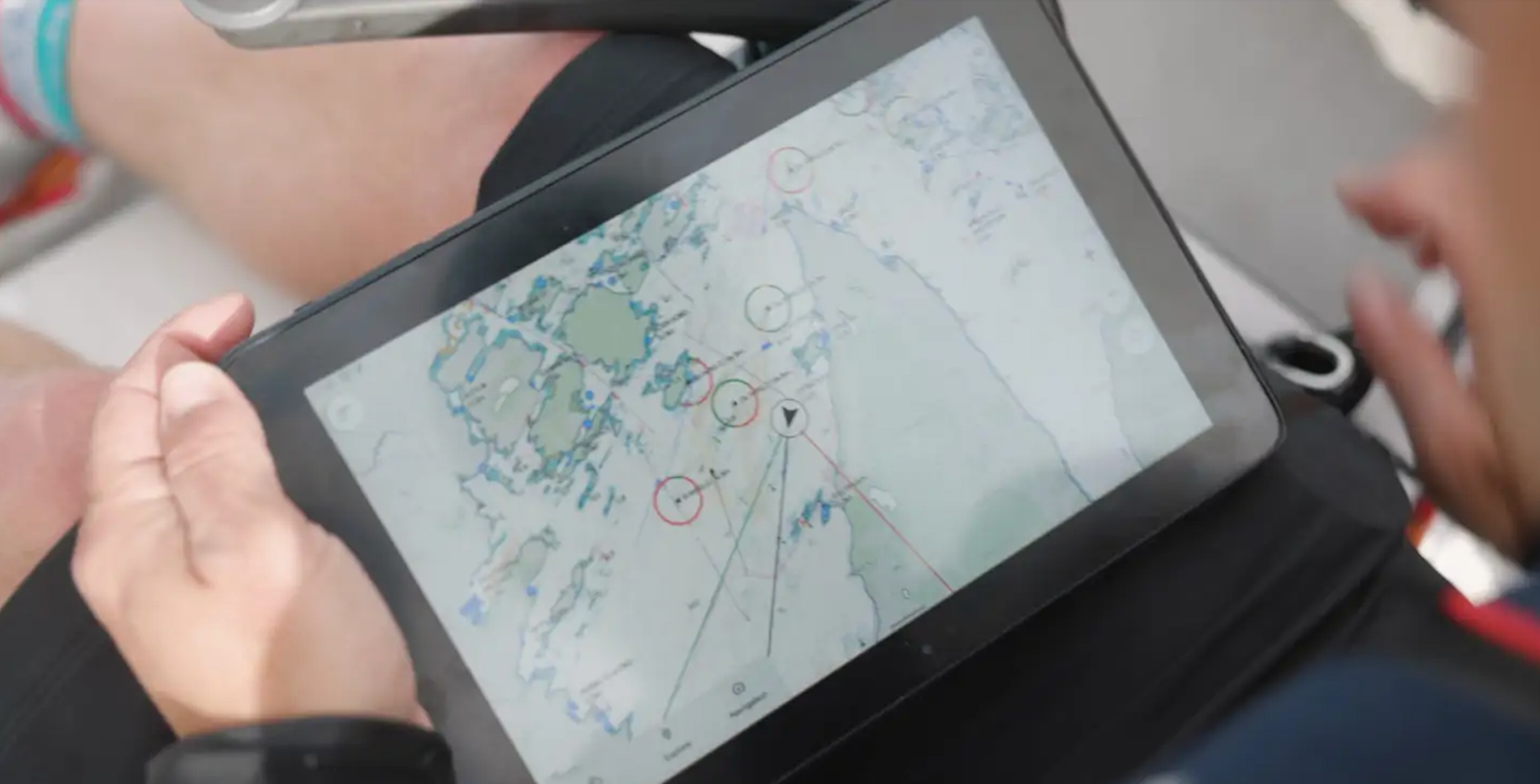
Orca Display on the go. Photo: Manufacturer
Affordable Despite Its Massive Capabilities
The app is free in its online version, so it can be thoroughly tested at home. Offline charts, satellite overlays, and weather routing require an annual subscription—available for a very affordable €49 per year. Chart coverage includes almost all of Europe, the USA, Australia, and the Caribbean. With this Plus subscription, the most important wishes of most sailors are already met.
Those who want to expand the app with features like a digital logbook, dynamic route recalculations, enhanced AIS with collision warnings, and more can upgrade to the Smart Navigation package for €149 per year. For under €150, the user receives a functionality scope that is second to none, including the aforementioned charts.
The app is available for Android and iOS. It runs across accounts, and in the Apple world, it can also be used on Apple Watches (WatchOS) to control the autopilot in combination with the Orca Core. A macOS version is also available.
The app is essentially the foundation of Orca. However, it can be expanded with proprietary hardware, consisting of two elements:
Orca Display 2
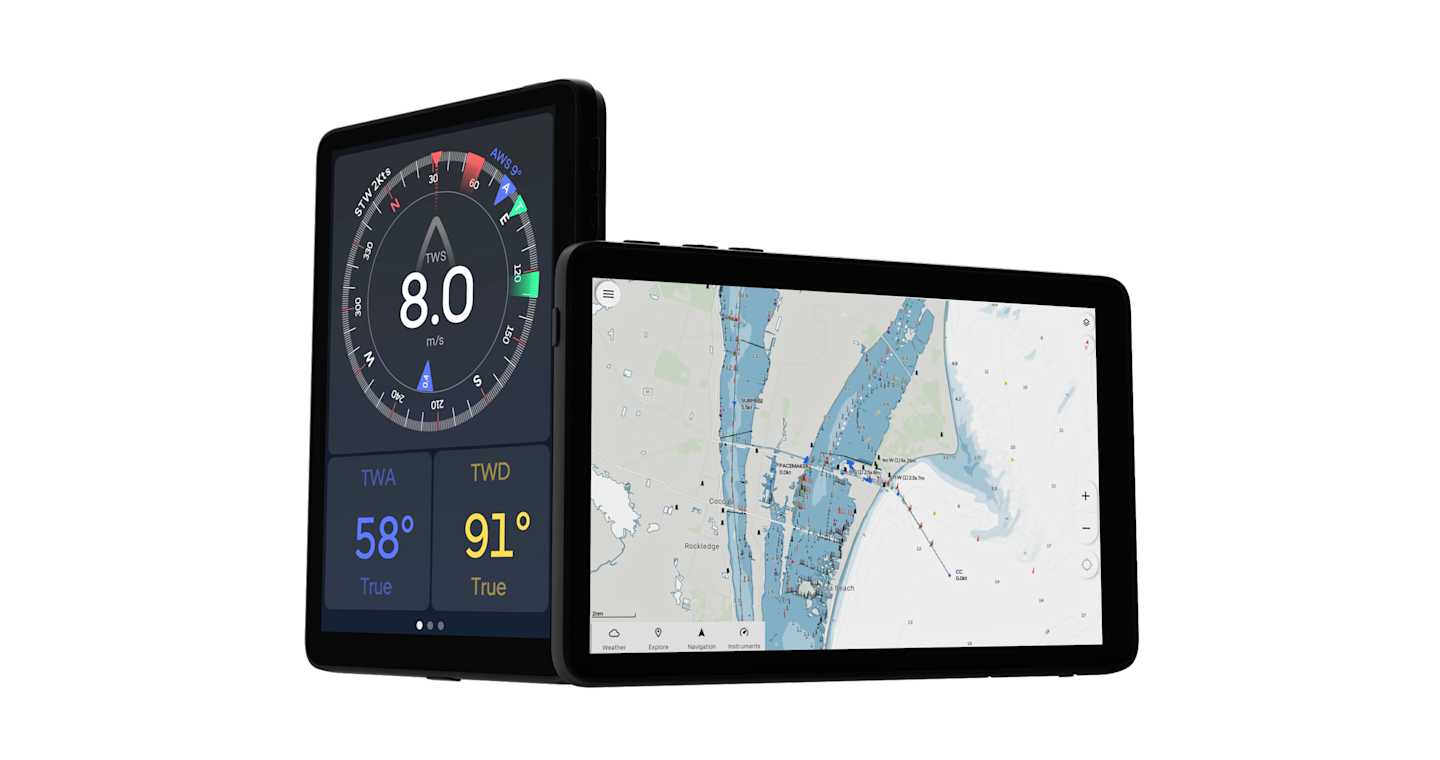
Many users of navigation apps often face the problem of compatibility: which tablet or smartphone works the best and how can it be adapted to onboard conditions? Orca addresses this with the companion tablet Orca Display 2 (€999), the perfect partner for the app. This Android-based, rugged tablet is protected against saltwater spray, readable even in sunlight, and designed for extreme temperatures – so it doesn’t shut off due to heat like most consumer tablets.
The topic of long-term power supply and mounting is addressed with the Orca Mount. When docked in the Orca Mount, the tablet charges inductively. Without a power supply, the Orca Display is said to last about eight hours in full navigation mode.
When you total up market prices for a professional tablet with a matte and bright display, a mount, a waterproof case, and a power supply, the 10-inch Orca Display is a relatively affordable all-in-one solution. A bare, current iPad Pro is already more expensive, without the necessary accessories for onboard use.
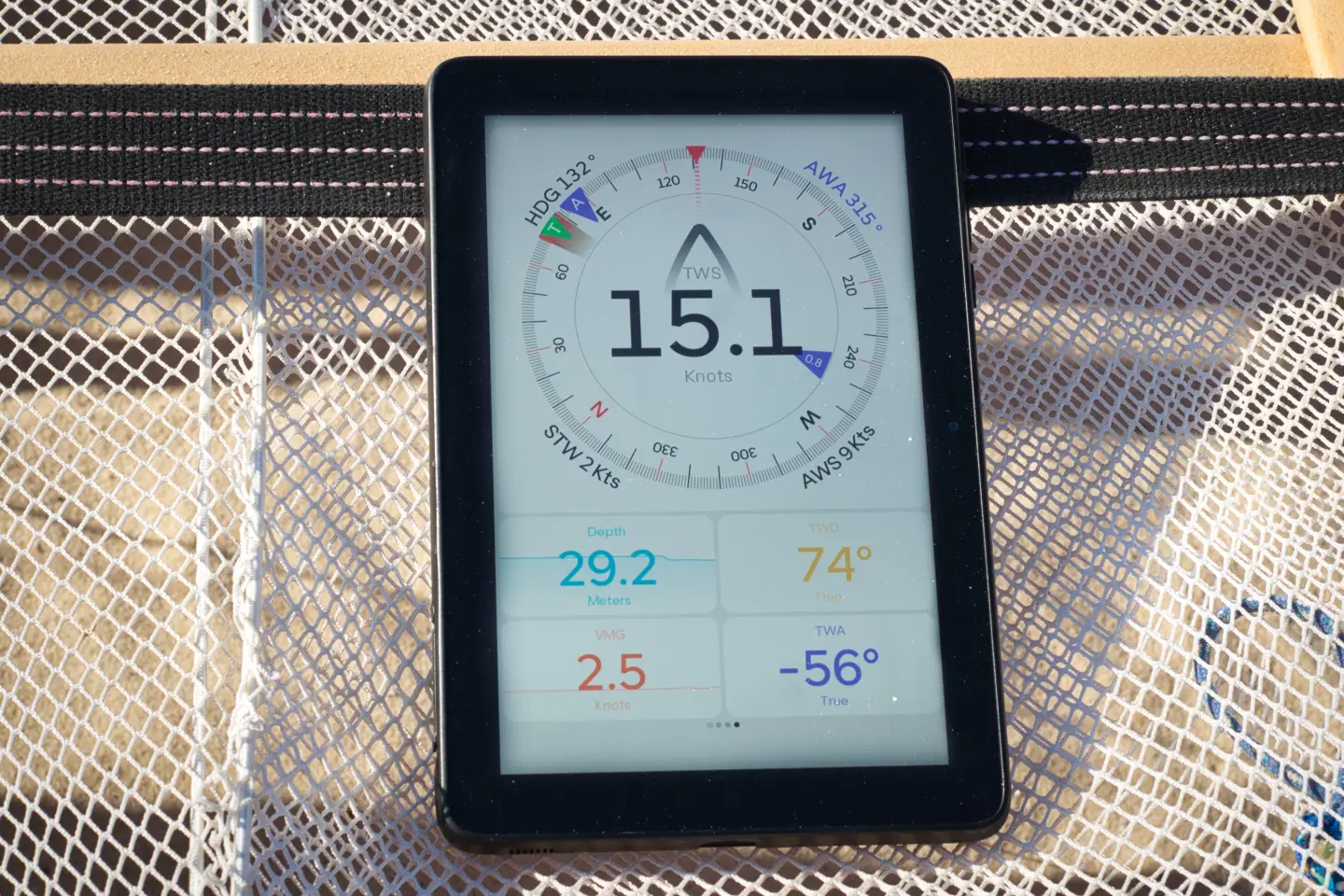
Handles sunlight well: Orca Display. Photo: Manufacturer
From App and Tablet to an Integrated Onboard System
Orca Core 2 is the name of a small white box that, together with the Orca App and Orca Display 2, forms a complete, integrated onboard system. The smart navigation unit with integrated GPS, compass, motion sensors, and a special sailing processor can be integrated into an existing onboard network via interfaces (NMEA 2000, Ethernet, WLAN, and Bluetooth). Autopilot, AIS, radar, and onboard sensors such as depth, log, and wind can be connected to the Orca Core.
From there, the data is sent wirelessly to the Orca Display and the Orca App (running on other tablets). Entire instrument pages can be created—freely configurable—transforming the tablet into a real multifunction display. On top of this, compatible NMEA 2000 autopilots can also be controlled wirelessly from the tablet or smartphone.
The app uses the data from the network for navigation, e.g., laylines, which are calculated and displayed based on wind sensor data. Orca Core's built-in GPS receiver is extremely accurate, and motion sensors like acceleration and heel are used to calculate wind data.
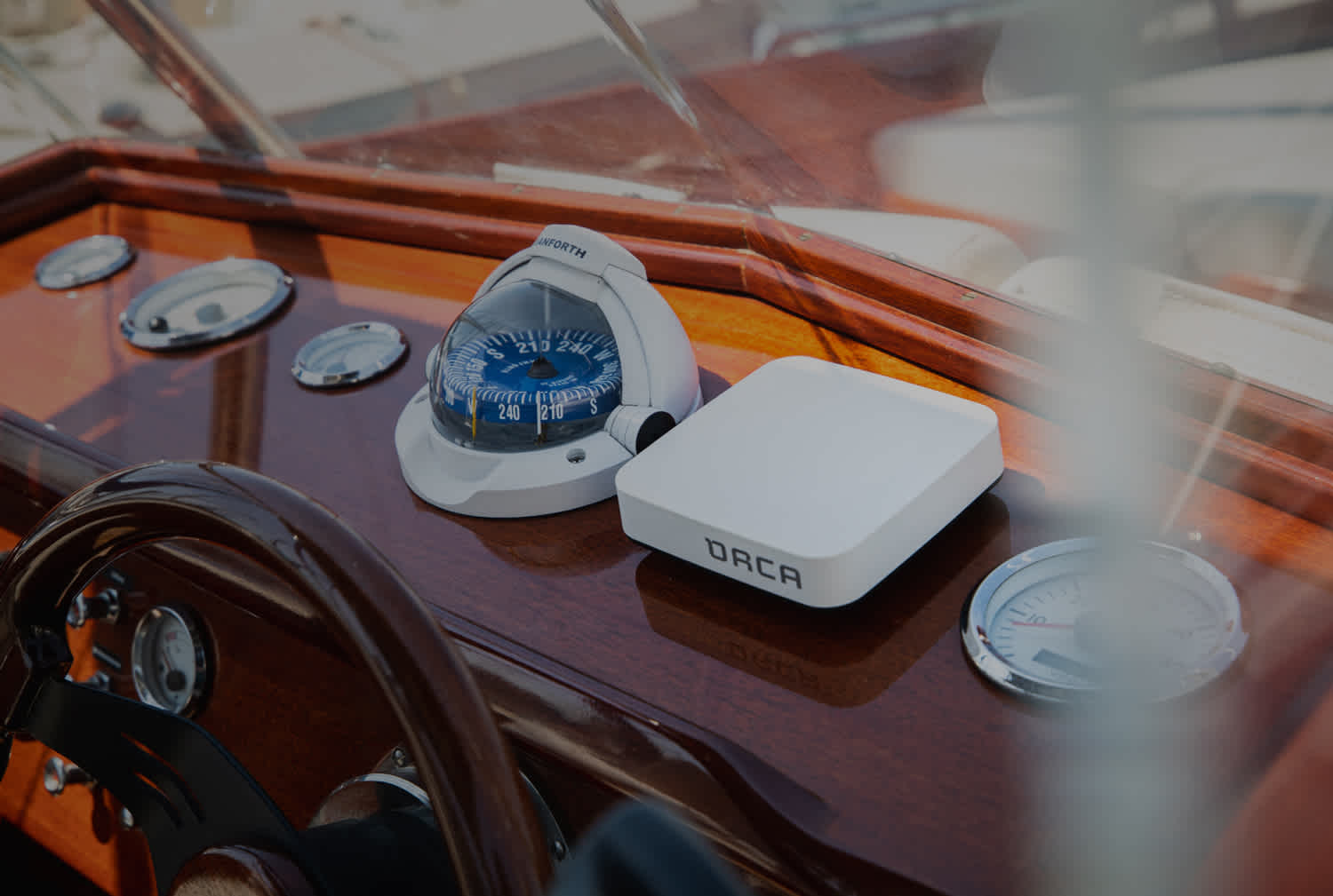
GPS receiver and NMEA interface: Orca Core. Photo: Manufacturer
Those who purchase the Orca Core also gain access to the logbook feature, which is included in the app but is only usable with the Core. The Core collects all available data from your boat, such as wind, speed, heading, and more. This data is turned into detailed logbook records.
Errors such as GPS jumps in the harbor or data gaps from briefly failed sensors are now automatically corrected. Graphs and averages now reflect realistic conditions.
Also recorded are sensor data like battery charge status, health, and remaining life—especially useful for lithium systems. The data is stored in the cloud within seconds and is always accessible.
Trips can now be exported as GPX files and shared with other tools (e.g., for position tracking).
Orca Guard Mode – Anchor Watch and Onboard Monitoring
“Guard Mode” is what Orca calls its smart safety feature for monitoring boat position at anchor. In its current version, it functions as a digital anchor watch: As soon as the boat leaves a previously defined safety zone, an automatic alert is triggered. Guard Mode also informs about unexpected position changes during anchoring. Even when you go ashore, the boat’s position remains under control.
Guard Mode monitors the boat’s location relative to a set safety zone. If deviations occur, the system sends alerts to connected Orca devices. Operation is possible in three variants. Fully connected: The Orca Core is online (e.g., via WLAN or hotspot) and transmits data to the Orca Cloud. All connected devices with internet receive notifications. If the Core is offline, a smartphone or tablet with the Orca App takes over data transmission. The app must remain active and connected to the Core. If there is no internet, the Core sends data directly to the locally paired device.
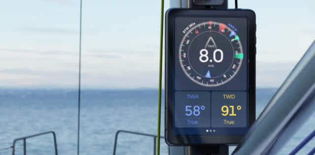
Orca Mast Mount. Photo: Manufacturer
Orca Mount: Tablet Mount in Various Versions
The mounts suitable for the Orca tablet are available in different versions to meet the respective onboard requirements:
Top Mount
The top mount installation requires little space and is perfect for compact dashboards or small areas. The adjustable mount can tilt and rotate—for optimal visibility from any position. The entire mount is hidden behind the Orca tablet, making it discreet and unobtrusive.
Surface Mount
Flush mounting on smooth surfaces gives the helm station or bulkhead next to the companionway a nice look. The custom-fit mount was developed to cover cutouts from earlier chartplotter installations neatly. A surrounding sealing edge on the back ensures reliable water resistance. It supports cutouts with a minimum size of 120 × 120 mm and up to 220 × 160 mm.
Also suitable for mast mounting
Instruments on the mast are visible from various angles on board, so the entire crew always has wind and performance data in view. The Orca Charging Mount for mast installation fits exactly on the base of a Garmin GNX 120 and can be replaced without further adjustments. Alternatively, any VESA-compatible mount with a 100 × 100 mm base can be used for mast mounting.
Installation and Compatibility
As complex as the Orca system may be, the installation and connection to an existing onboard network is manageable even for DIYers. Orca offers video chat support, among other things.
Orca is compatible with most modern marine electronics systems—including Raymarine, B&G, and Garmin. With a converter cable, the following network standards can be connected:
NMEA 0183
NMEA 2000
SeaTalk1
SeaTalkNG
NKE Topline
SimNet
Summary
Orca has succeeded in expanding and professionalizing navigation based on an app, establishing itself as a serious player in the marine electronics market. Functions, scope, ease of use, compatibility, and easy onboard installation make the Orca App, Orca Core 2, and Orca Display 2 a complete navigation system—even for demanding voyages and offshore cruising. The complete package is significantly more affordable than comparable professional marine electronics.
The Orca hardware can be ordered from the manufacturer’s store. Orca also offers a support chat for onboard installation and helps users get set up via video call.
Costs: Using the app with offline maps costs €49/year under the Orca Plus plan. The Smart Navigation plan, which includes the Core, costs €149/year. Plus is included in that.
Orca at a Glance
Orca App
Cross-platform availability: Free app for iOS and Android devices with online charts, automatic route planning, weather forecasts, and essential navigation features.
Offline charts: Downloadable and usable offline with an Orca Plus subscription.
Satellite hybrid charts: Provide detailed views for harbor approaches and anchorages.
Automatic route planning: Considers boat-specific data (including polar diagrams) and weather conditions to generate optimal routes.
Weather integration: Offers real-time weather radar, wave and tide information, and alerts for changing weather conditions.
Orca Core
Smart navigation unit: Includes GPS, compass, motion sensors, and a sailing processor.
NMEA 2000 connectivity: Connects to onboard systems like AIS receivers and autopilots, transmitting sensor data wirelessly to the Orca App and Display.
Autopilot control: Enables direct control of compatible autopilots via the app.
Radar overlay: Supports radar data integration for improved situational awareness.
Remote access: Allows monitoring of vessel location and battery status remotely.
Orca Display
Marine-optimized tablet: 10.1-inch Full HD display designed for extreme temperatures and maritime environments.
Flexible mounting: Comes with a wireless charging station; can be detached and used portably.
Standalone usage: Integrated GPS and compass allow it to function as a navigation device even without the Orca Core.
Subscription Plans
Orca Plus (€49/year): Includes offline charts, satellite hybrid maps, and sail-specific route planning.
Smart Navigation (€149/year): Adds dynamic route recalculation, advanced AIS with collision warnings, and an automatic logbook. Includes all Orca Plus features.
Transparency Note: This post is a paid advertorial.

