All Articles
Tested: ORCA as a Navigation Solution for Yachts
July 17, 2025 • 8 min read
Orca Unites the Best of Both Worlds — A System Worth a Closer Look
This article was originally written by Sönke Roever in German and published on BLAUWASSER.DE on June 11th, 2025. The translation and following publication have been approved by the original author.
About the author:
With 100,000 nautical miles under his belt, Sönke Roever has circumnavigated the globe with his wife Judith from 2007 to 2010. He organizes seminars at boat shows, and is the author of “Blauwassersegeln kompakt”, “1200 Tage Samstag”, and “Auszeit unter Segeln”. Sönke is also the founder of BLAUWASSER.DE and is regularly out on the water with his wife Judith and their children aboard the Gib’Sea 106 - HIPPOPOTAMUS.
Orca Unites the Best of Both Worlds—A System Worth a Closer Look
The founders of Orca have been active in the marine electronics industry for many years and asked themselves: Why do so many sailors, even those with a chartplotter, still rely on mobile apps on their smartphones or tablets for passage planning and navigation at sea?
Their research, some years ago, revealed that chartplotters reminded users of old car navigation devices, predating Apple Carplay and Android Auto. Mobile devices, on the other hand, were easy to use but lacked reliability: they were difficult to operate in rain or spray, prone to overheating, and required frequent recharging.
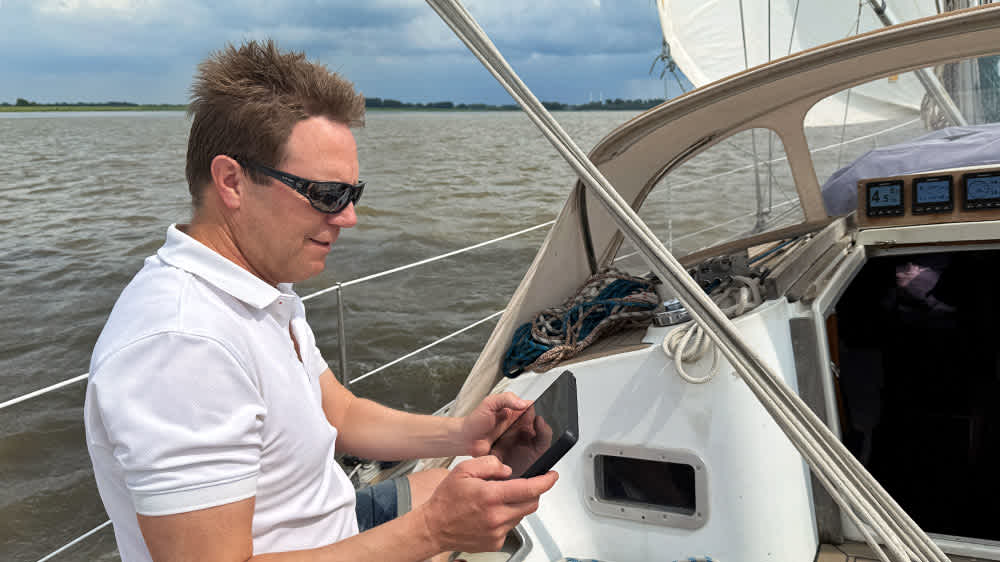
Test run with the Orca system. ©Sönke Roever
Against this backdrop, the founders developed Orca—a system that combines the advantages of chartplotters with those of smartphones and mobile apps. Orca has been continuously developed and is now a state-of-the-art, comprehensive navigation system that truly brings together the best of both worlds. Navigation is performed on a robust, weatherproof Android tablet, and the system can communicate with nearly all other devices in a yacht network.
This piqued my interest, and I acquired the Orca system to test it thoroughly onboard. Here, I present my findings. Spoiler: I am thoroughly impressed. The developers have clearly put a lot of thought into this product, combining a host of practical features to make navigation easier—all in a single device, including its own charts.
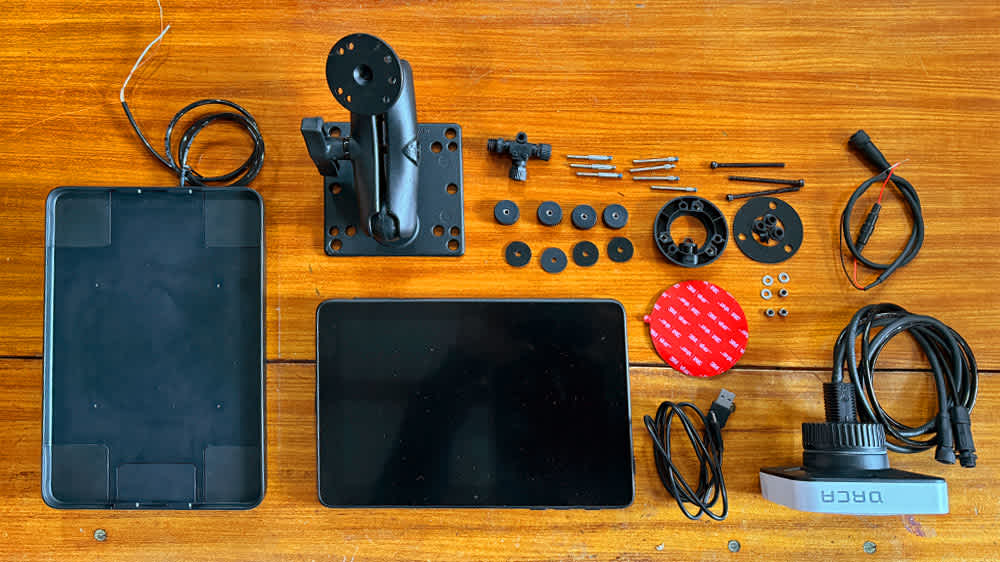
The components of the Orca navigation system. ©Sönke Roever
Components of the Orca Navigation System
Orca App
The heart of the Orca system is the Orca App, a feature-rich navigation software with proprietary charts, weather routing, and many other practical navigation functions. With the Orca App, iOS, WatchOS, and Android devices can serve as professional chartplotters.
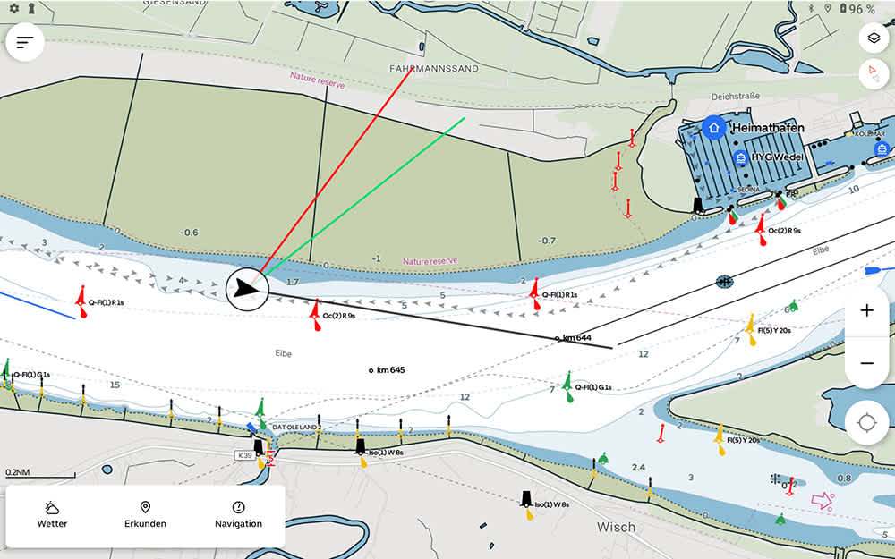
The heart of the Orca system is the Orca App. ©Orca/BLAUWASSER.DE
Orca Display
For users who prefer not to expose their personal devices to the harsh conditions at sea, Orca offers a dedicated tablet—the Orca Display. This ultra-bright marine tablet withstands extreme temperatures and weather. In comparison with an iPad, I found it significantly brighter and the touchscreen was much easier to use in rain and humidity.
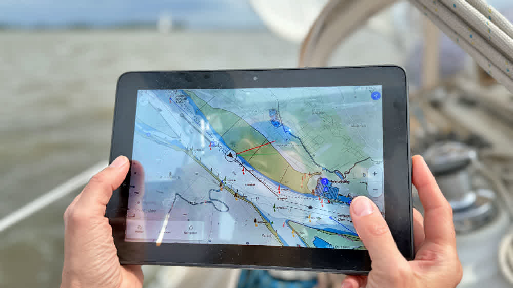
The Orca Display is an ultra-bright marine tablet. ©Sönke Roever
The Orca Display, with its built-in high-precision GPS and compass, also functions as a standalone navigation device. Users can switch between day and night modes; the night mode uses red hues to preserve night vision.
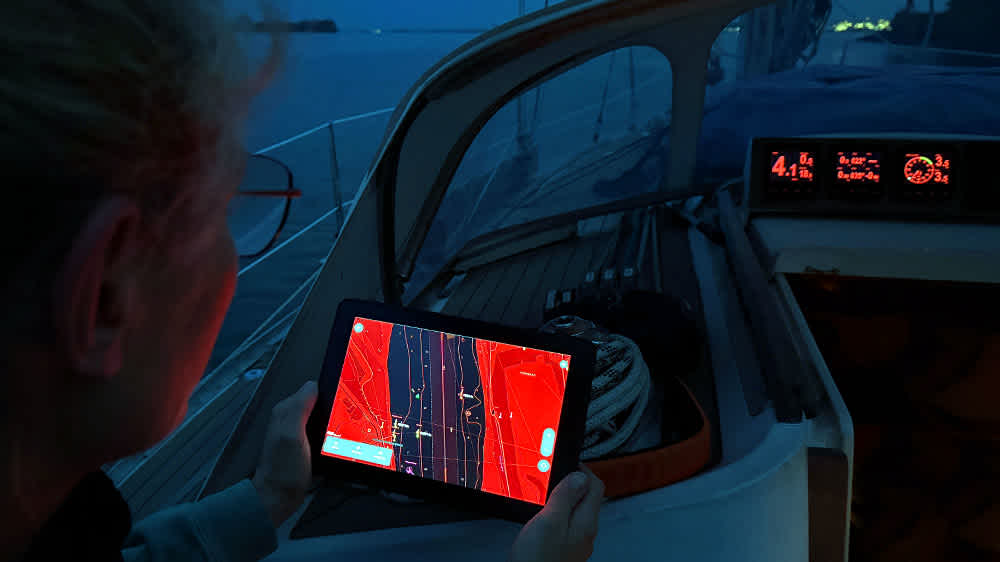
You can switch between day and night mode on the Orca Display. ©Sönke Roever
Technical Data (Orca Display):
Dimensions: 262 x 175 x 19 mm
Screen size: 10 inches
Resolution: 1920 x 1080 pixels
2.2 GHz – 8-core CPU
1.1 GHz – Dual Core
4 GB LPDDR4x RAM
WiFi interface
USB-C charging port
Up to 8 hours navigation from the integrated 9,500 mAh battery
Weight: 870 grams
SIM card and SD card slots
Waterproof rating: IP-X6
Temperature range: -15°C to +55°C
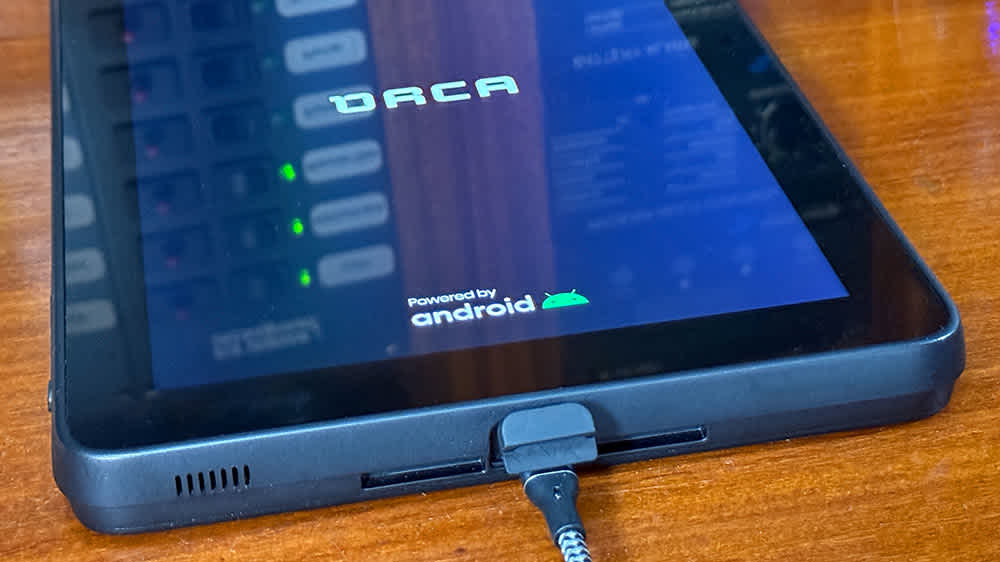
The Orca Display has a very long battery life. ©Sönke Roever
The Orca Display features four external buttons: one for power/standby, two for zooming in/out or adjusting volume, and a fourth that centers the vessel on the chart—a very handy feature.
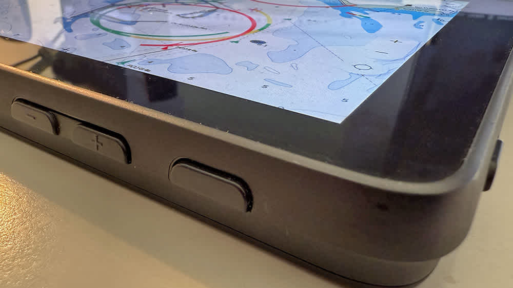
The Orca Display has four buttons on the outside. ©Sönke Roever
Orca Mount
The Orca Mount is an optional bracket that connects to the yacht’s 12V or 24V system and offers wireless charging—very useful in damp conditions. The included swivel arm is sturdy and easily adjustable.
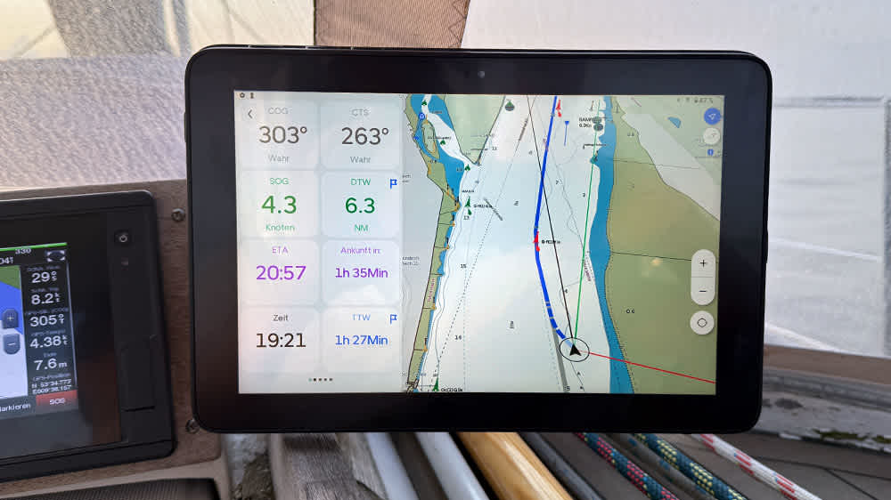
The Orca Display in the Orca Mount bracket. ©Sönke Roever
Alternatively, a flush-mount version is available for surface installation, providing a sleek, integrated look.
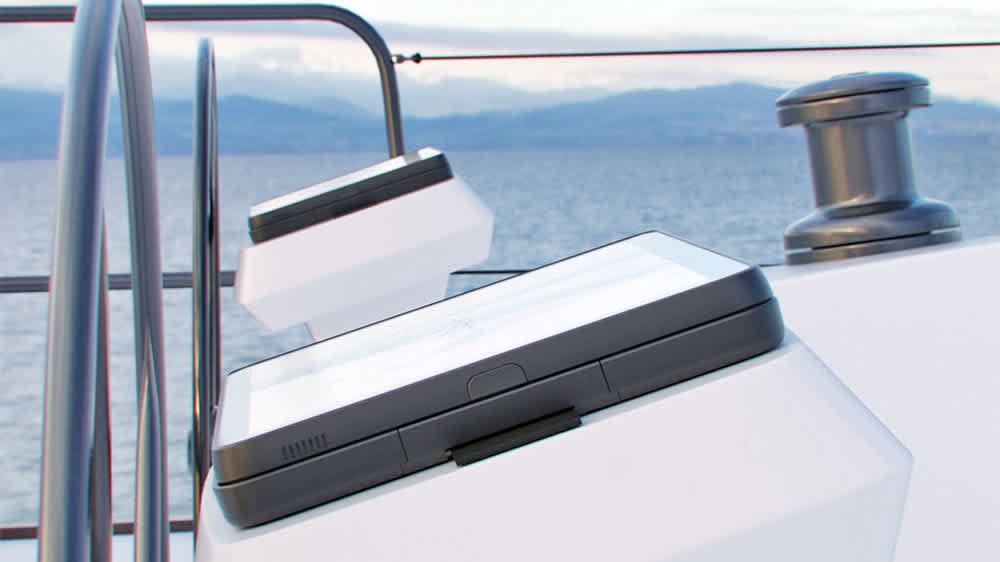
Alternative: The bracket can also be surface-mounted. ©Orca
Orca Core
Completing the system is the Orca Core, a smart interface featuring GPS, compass, heel sensor, and sailing processor. Connected via NMEA 2000, the Orca Core can communicate with external devices such as AIS receivers and autopilots. All data is transmitted wirelessly to the Orca App and Display. This also allows routes to be imported/exported or for the autopilot to be controlled via the Orca Display.
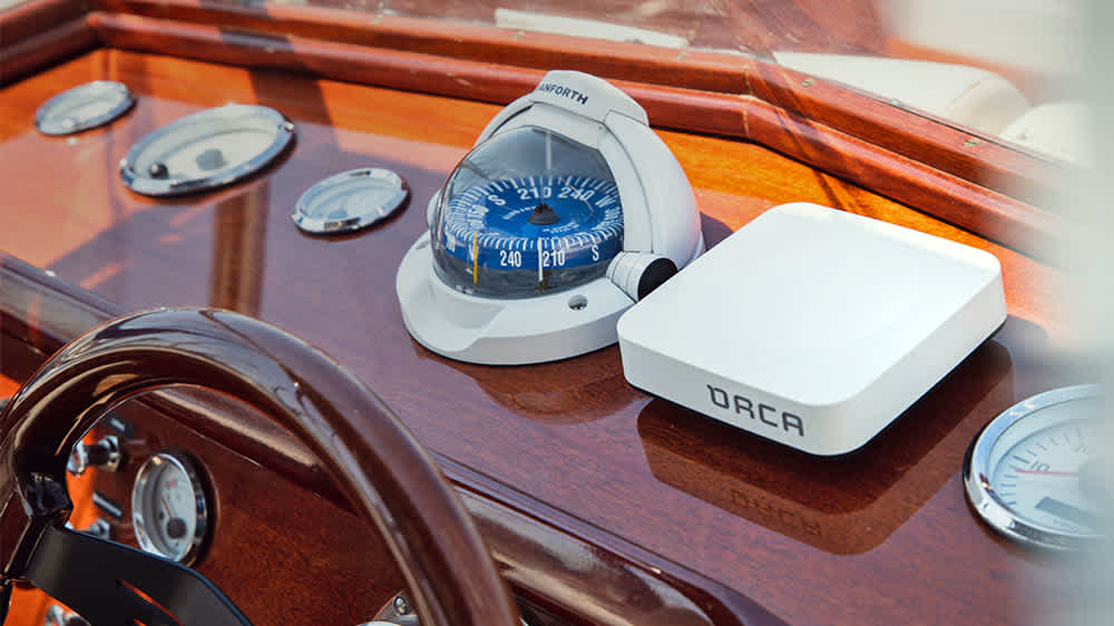
Example of Orca Core installation at a helm station. ©Orca
Technical Data (Orca Core):
Dimensions: 118 x 118 x 35 mm
GPS accuracy: 1.5 meters at 10 Hz update rate
9-axis motion sensor with compass (accuracy under 1.5°)
NMEA 2000 interface
Power supply: 9–32 V, power consumption: 200 mA
WiFi interface
Waterproof rating: IP-X6
Temperature range: -15°C to +60°C

Relaxed passage planning with the Orca Display. ©Sönke Roever
Note: I tested all components individually and in combination. I quickly realized that the Orca Display, with its ruggedness and long battery life, together with the Orca Mount and Orca Core, creates a brilliant, comprehensive system—offering a fully mobile navigation solution with an incredible range of functions.
Installing the Orca Navigation System
Installation is straightforward. On first startup, the Orca Display follows the typical tablet setup routine: select language, activate SIM card (if used), install apps, configure services, create a user account, and install the Orca App.
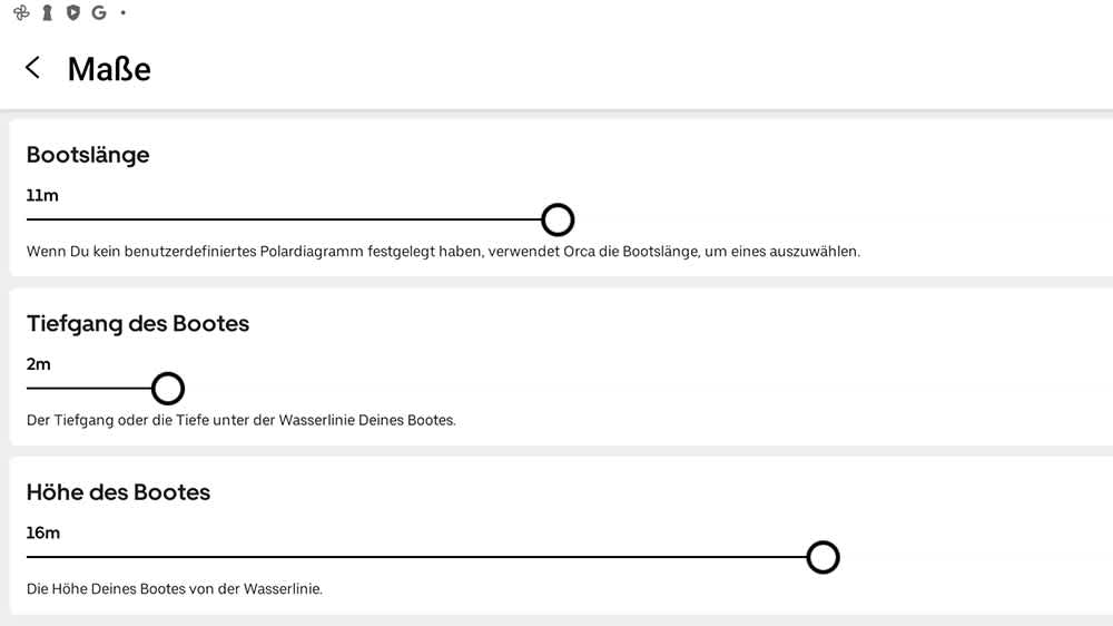
During setup, you can also enter your yacht’s data. ©Orca/BLAUWASSER.DE
You can also enter your boat’s data—type, length, draft, and height—during setup. These should be entered carefully, as they are considered when routes are automatically generated. Units (e.g., wind speed in knots, Beaufort, km/h, or m/s) can also be set.
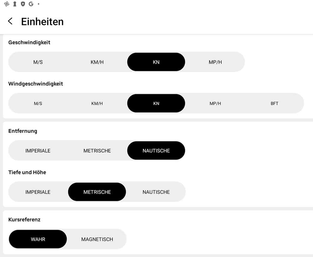
Units can be set in the settings. ©Orca/BLAUWASSER.DE
With this setup, I sailed a charter boat in the Mediterranean and found it worked very well. The only downside was not being able to access data from the yacht’s navigation network (e.g., speed through water, wind direction, wind speed). Therefore, on our editorial boat, I also installed the Orca Core data interface.
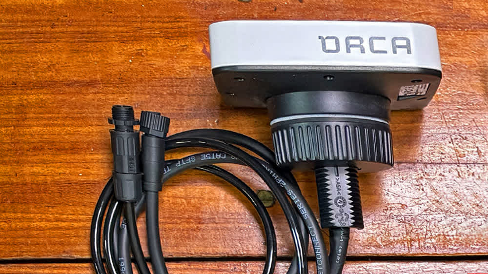
The Orca Core data interface. ©Sönke Roever
Installing Orca Core is simple: just add another T-connector into the NMEA 2000 network (included��—kudos!) and connect the Orca Core’s drop cable. Power is supplied via NMEA 2000. You can also use Orca Core standalone, but then you lose much of the available navigation data.
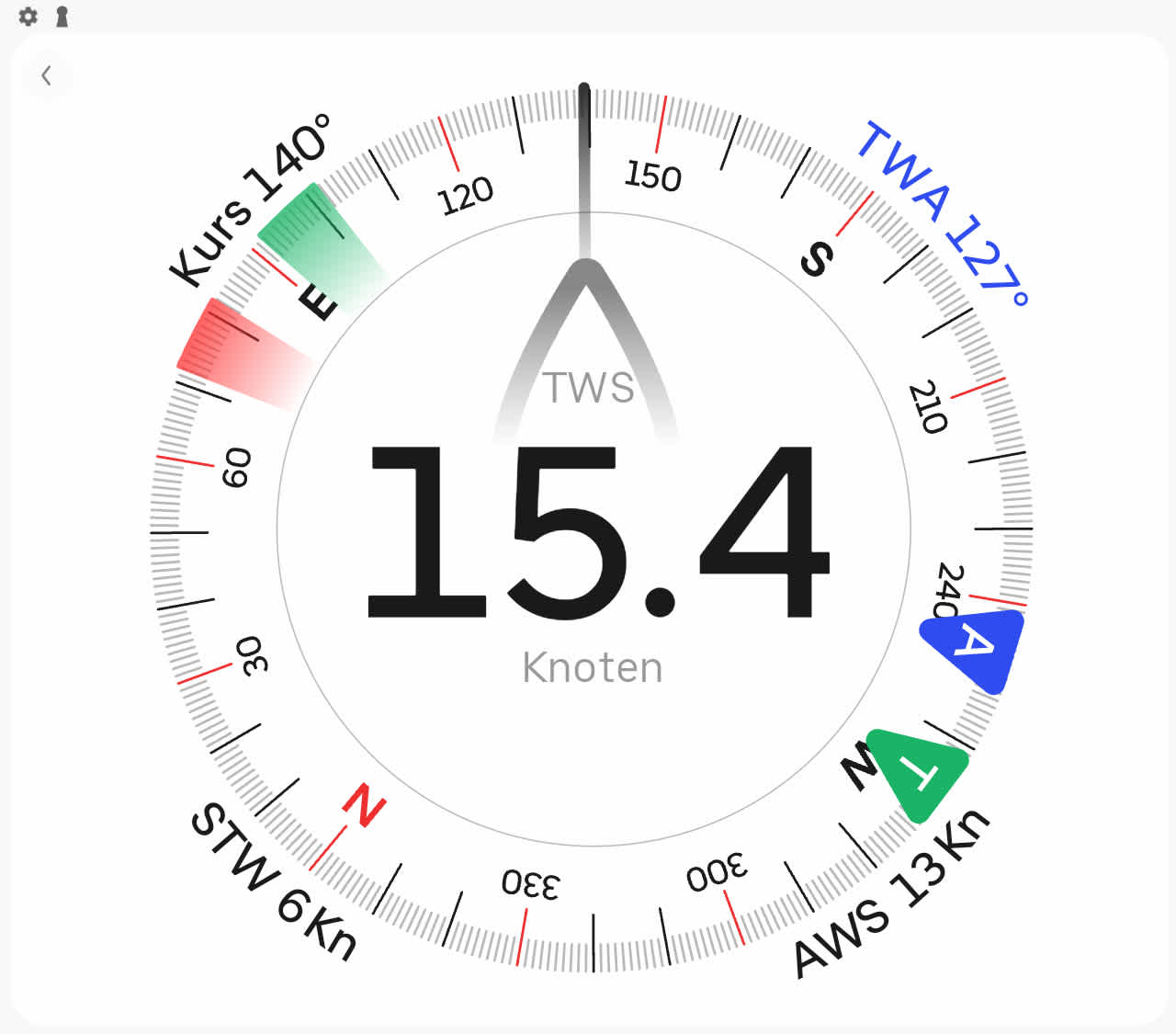
Wind data can be displayed via Orca Core. ©Orca/BLAUWASSER.DE
After switching on, the Orca Display and Orca Core connected effortlessly, and within seconds, nearly all network data was available on the Orca Display: wind data, water depth, speed, heading, AIS data, battery status, tank levels, and autopilot information.
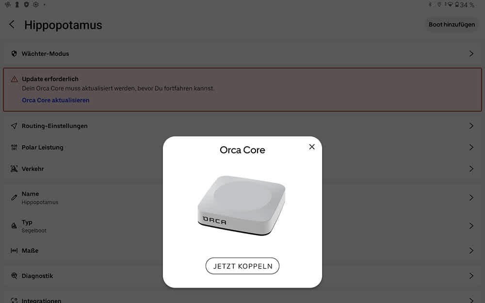
Pairing with Orca Core is straightforward. ©Sönke Roever
A useful feature is the ability to choose which data source is used—for example, whether GPS position should come from Orca Core or another onboard GPS device via NMEA 2000.
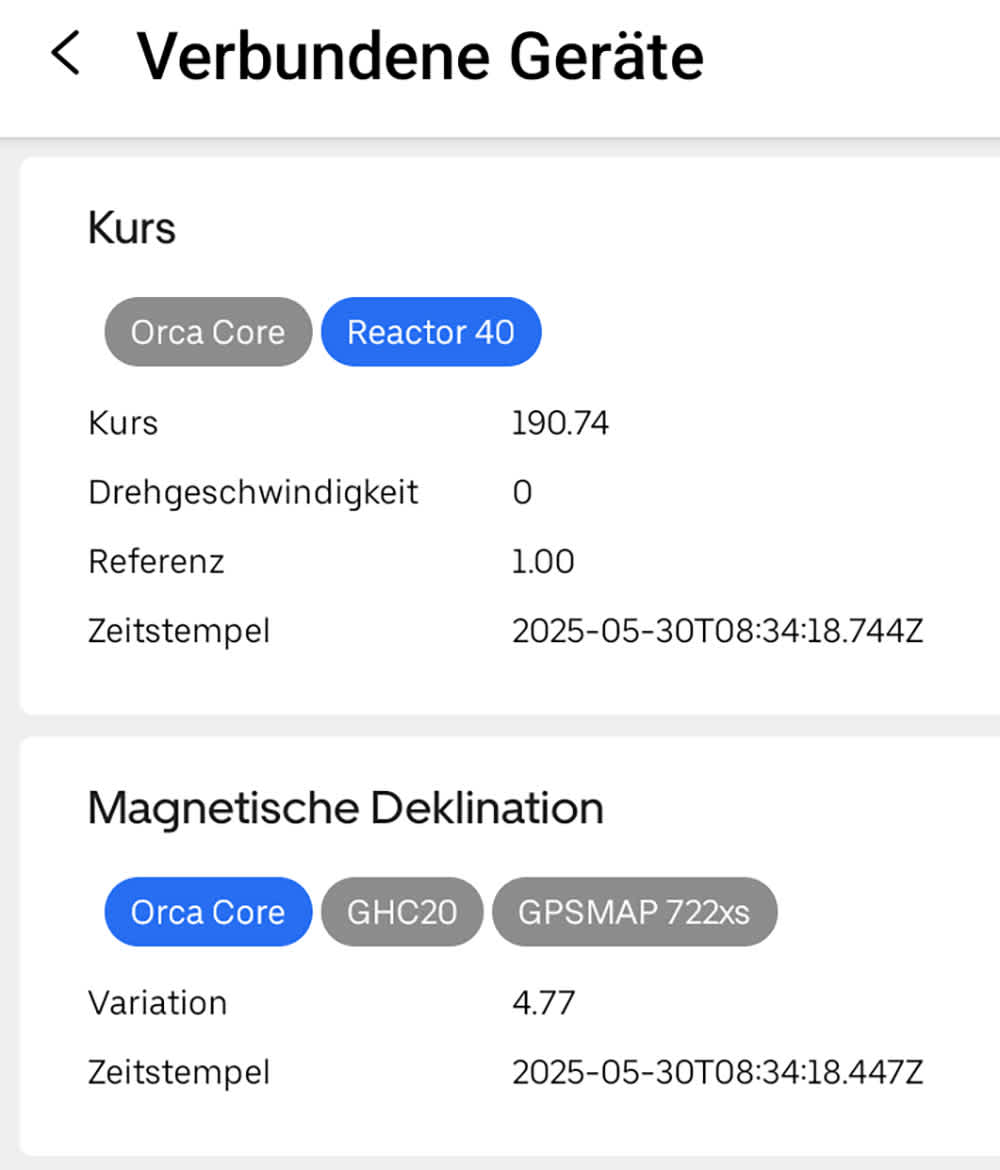
You can configure which data source should take priority (highlighted in blue). ©Sönke Roever
To complete the setup, I installed the Orca Mount in the cockpit. This gives the Orca Display a fixed, charging station when not used portably. It’s easy to remove and reinsert, and the robust swivel arm allows for optimal positioning and orientation.
Orca’s Chart Display
The main function is, of course, navigation with the chart. Orca’s charts have their own layout, modeled after standard nautical chart color schemes. Display can be 2D or 3D, with north-up or aligned to the course (course-up or head-up).
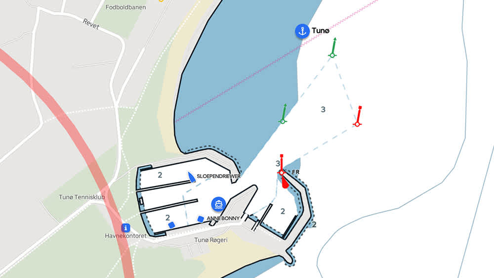
Orca has its own design for chart display. ©Orca/BLAUWASSER.DE
The charts are included with the system—no extra purchase required. Chart data comes from various hydrographic offices worldwide, such as Germany’s BSH and the Federal Waterways and Shipping Administration. The charts are continuously updated, so you always have the latest data. Coverage areas are listed on the Orca website and are expanding steadily, already covering major parts of the world.
If the tablet is online (via mobile or WiFi), charts are loaded automatically when zooming into a region. Alternatively, charts can be downloaded for offline use—ideal for trips abroad without roaming or ocean crossings.
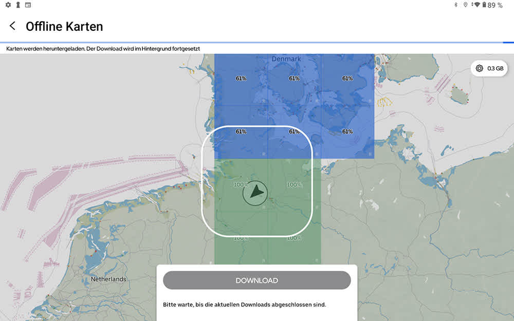
Charts can be downloaded for offline use. ©Orca/BLAUWASSER.DE
Aids to navigation are clearly displayed with their identifiers, which is not always the case with other apps and can complicate night navigation. The vessel’s track is also plotted, with the spacing of track points varying by speed.
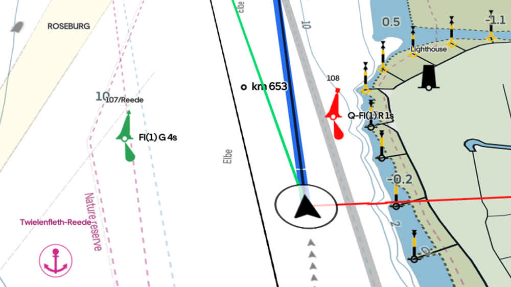
On the chart (here in 3D view), navigation marks are shown with their identifiers. The track is marked with gray triangles. ©Orca/BLAUWASSER.DE
Shallow areas can be shaded, and bridges with insufficient clearance are marked in red.
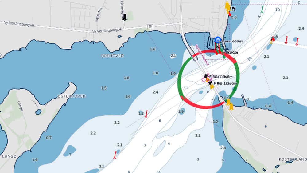
Shallow water areas can be highlighted in blue on the Orca chart. ©Orca/BLAUWASSER.DE
Satellite imagery can be overlaid on the chart, providing comprehensive orientation and helping assess the attractiveness of anchorages.
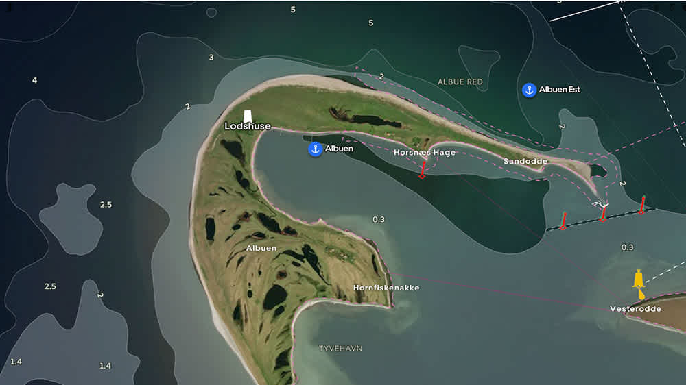
The combination of chart and satellite image offers comprehensive orientation. ©Sönke Roever
Navigation with the Orca System
The Orca App offers a full-featured navigation system. This includes displaying your position on the chart with a course vector or target line, as well as optional laylines. I particularly appreciate that the target line can be set dynamically based on speed or with a fixed length.
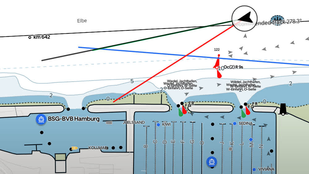
In this example, the vector is set to a length of ten minutes. ©Orca/BLAUWASSER.DE
Various panels can display navigation data such as course over ground, speed over ground, position, and more. With Orca Core connected to the yacht’s navigation network, even more data is available.
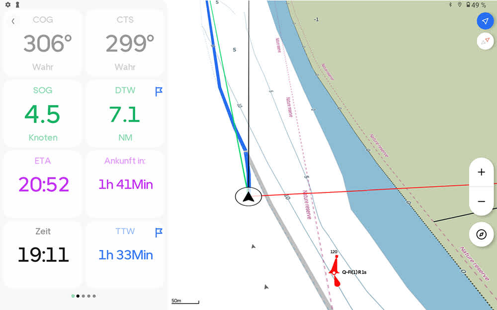
Example of navigation data displayed in Orca. ©Orca/BLAUWASSER.DE
A digital divider is included for measuring distances and bearings, simplifying passage planning. The only drawback: accessing this feature requires navigating through a menu, rather than being available at the top level.
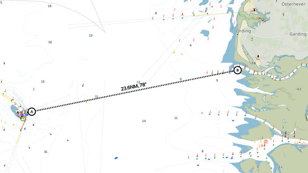
Distances and courses can be measured with Orca. ©Orca/BLAUWASSER.DE
Using Routes and Waypoints
Another exciting feature is Orca’s route and waypoint planning. For routes, you can choose between automatic or manual creation. In automatic mode, the system finds the optimal route to a destination based on preferences such as minimum water depth or minimum distance from shore.
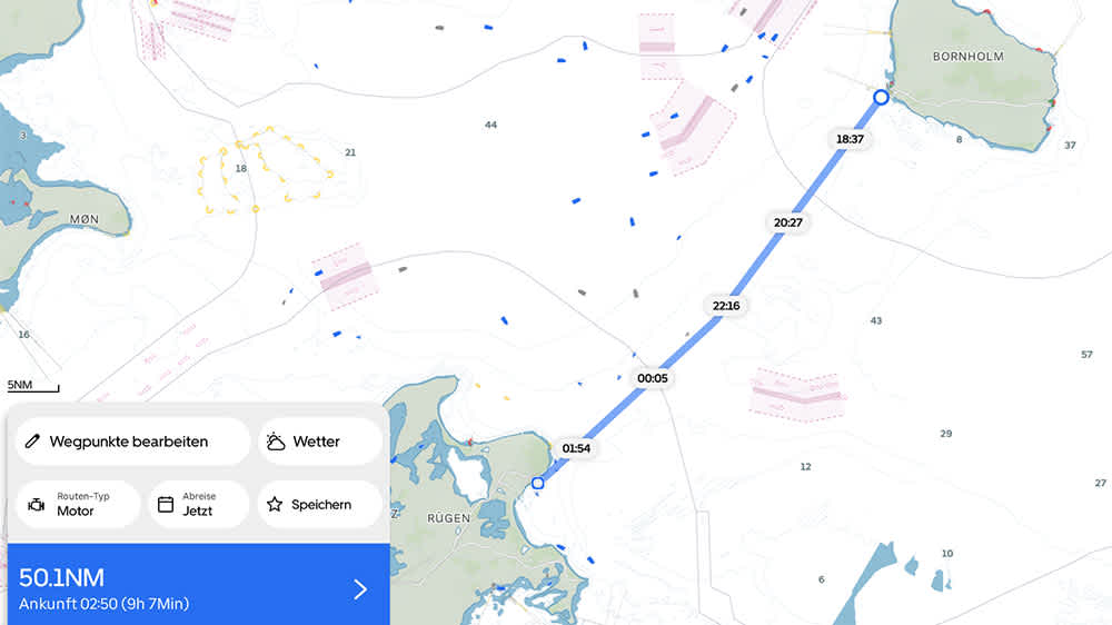
Example of a route under engine from Bornholm to Rügen, with times. ©Orca/BLAUWASSER.DE
You can also specify whether the route is under sail or engine. For motor routes, the system displays the time you’ll reach each point along the route (requires Orca Core connection and a set engine speed). For sailing routes, it shows predicted wind along the route (requires internet, Orca Core, and a polar diagram for the yacht—many models already have one preloaded).
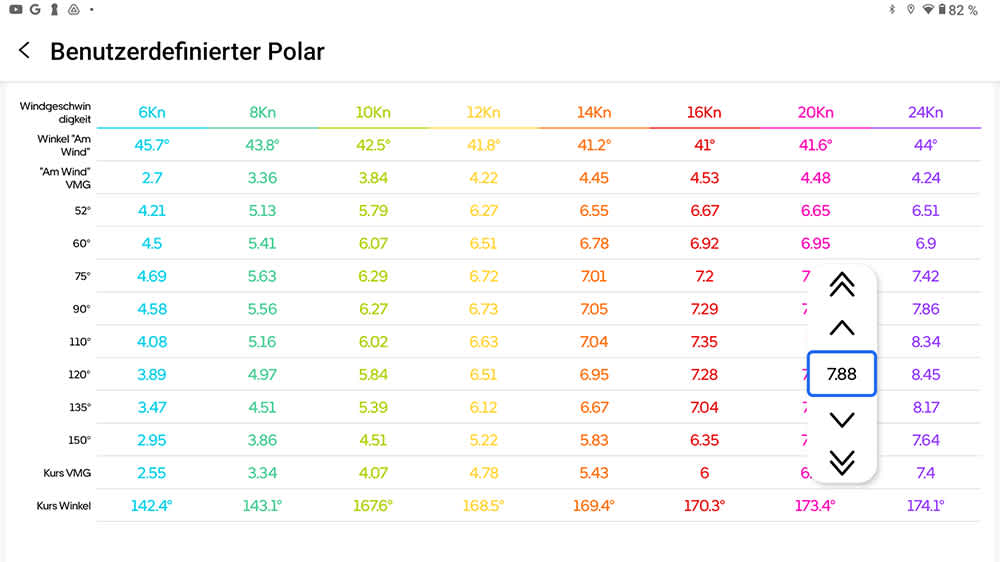
The yacht’s polar diagram can be stored and adjusted at any time in Orca. ©Orca/BLAUWASSER.DE
If the wind is on the nose, the system recognizes this and calculates tacking legs based on the polar diagram, providing weather routing for the optimal course.
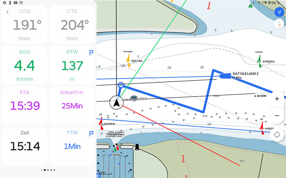
Tacking legs are calculated based on performance data. ©Orca/BLAUWASSER.DE
While sailing, the polar diagram enables a useful performance check: Orca compares your current speed to the target speed from the polar diagram and displays your performance as a percentage.
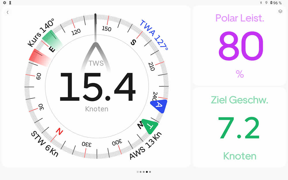
Here, the yacht is sailing at only 80% of the target performance from the polar diagram. Either the polar diagram is too optimistic or the sail trim is off. ©Orca/BLAUWASSER.DE
Waypoints forming the route can be transmitted via Orca Core into the NMEA 2000 network. I was able to view waypoints from Orca’s calculated route on Raymarine repeaters in the cockpit.
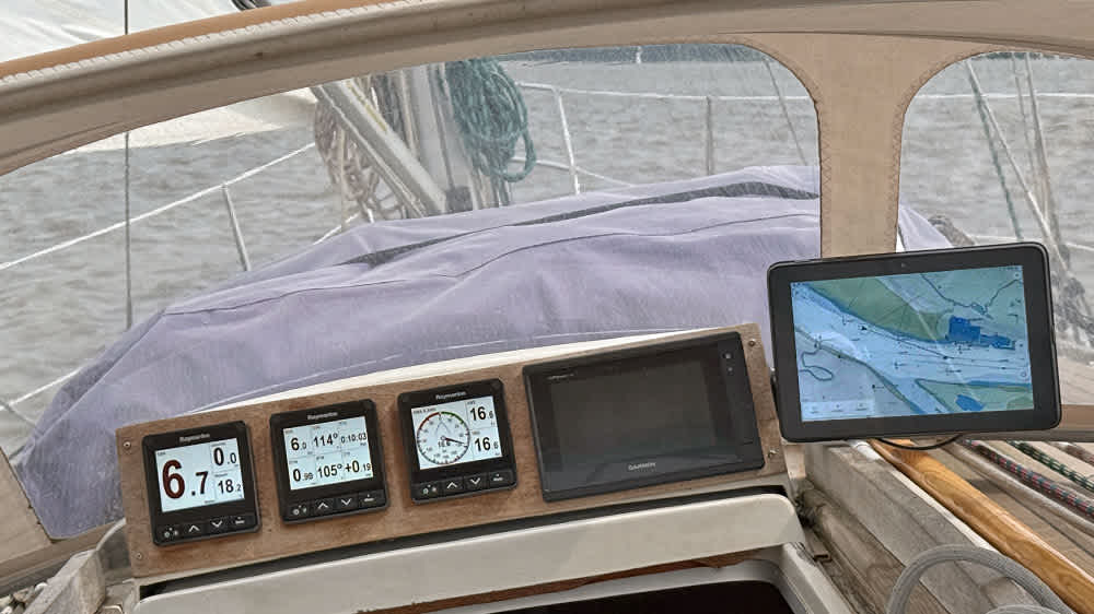
Orca can communicate with the existing network via Orca Core. Here with Raymarine repeaters. ©Sönke Roever
Waypoints can also be transferred to Raymarine Axiom plotters. Values such as ETA, remaining time, course to waypoint, and distance to waypoint can be displayed on the Orca Display. For this, the app alone suffices—no Orca Core required.
Autopilot Integration
A standout feature is that, thanks to network integration via Orca Core, the system can also interface with autopilots from selected manufacturers. Currently, this works with B&G, Lowrance, Simrad, Raymarine, Garmin, and YachtD, though functionality varies by brand. Orca maintains a compatibility article, which is regularly updated and worth checking.
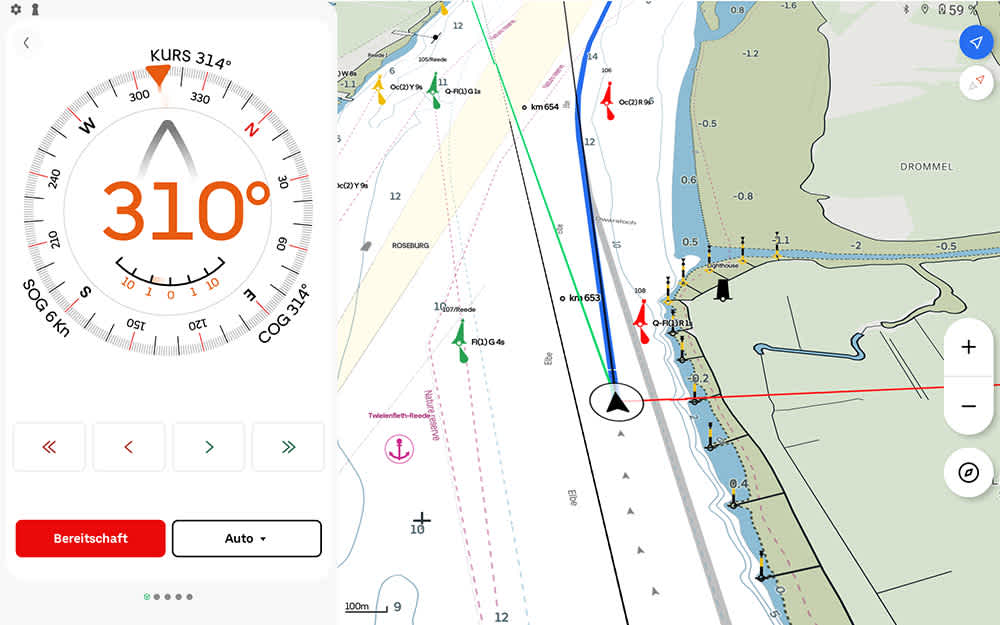
Autopilot control via the Orca Display. ©Orca/BLAUWASSER.DE
During my test, I connected with a Garmin Reactor 40 autopilot without issue. The Orca Display and Garmin display synchronized in both directions: course changes on either device were recognized by the other. This makes the Orca Display a fully functional, mobile autopilot control unit. Even more, routes programmed in Orca can be followed in autopilot “navigation” mode.
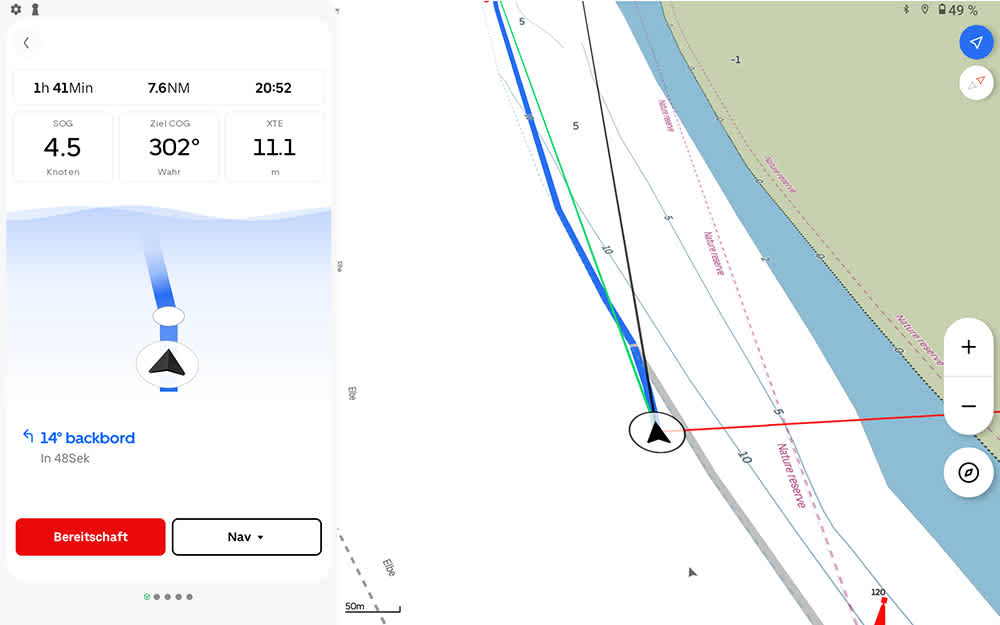
Here, the autopilot is following the automatically generated Orca route. ©Orca/BLAUWASSER.DE
AIS Display
Orca can display AIS data from multiple sources. If connected to an AIS receiver via Orca Core, received data is shown. With an internet connection, Orca also displays AIS targets outside immediate range with online data. Each signal is clearly marked as to its source, and only current internet AIS data is used.
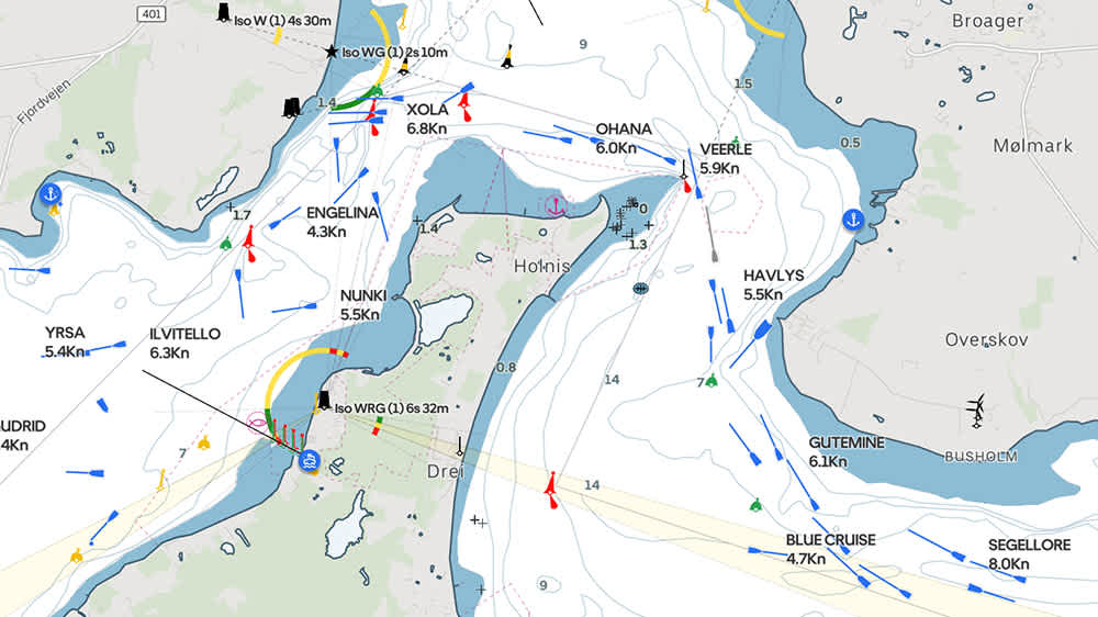
AIS signals on the Flensburg Fjord. ©Orca/BLAUWASSER.DE
The AIS layer can be toggled on or off, and vector length adjusted (I prefer ten minutes). Detailed information is available for each AIS target, including SOG, COG, distance, relative course, CPA, TCPA, and, where available, photos, call sign, MMSI, and signal class.
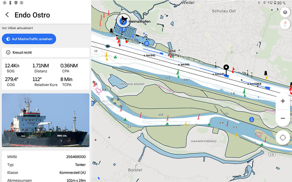
Example of an AIS data set. ©Orca/BLAUWASSER.DE
Logbook Functionality
With Orca Core connected, the system logs all relevant data for a logbook: trip overview with track (exportable as GPX), navigation data, wind, current, battery voltage, and fuel consumption.
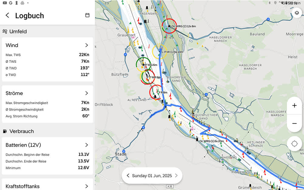
Example of a passage on the Elbe. The blue line is the track. ©Orca/BLAUWASSER.DE
Additional Features
Beyond the main features already described, Orca offers countless other functions. As a high-quality Android tablet, you can install any app from the Google Play Store.
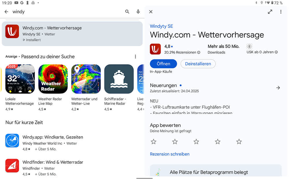
Apps from the Google Play Store can be installed on the Orca Display. ©Orca/Android/BLAUWASSER.DE
If connected to the internet, the Orca App can display information about harbors and anchorages via a partnership with Navily.
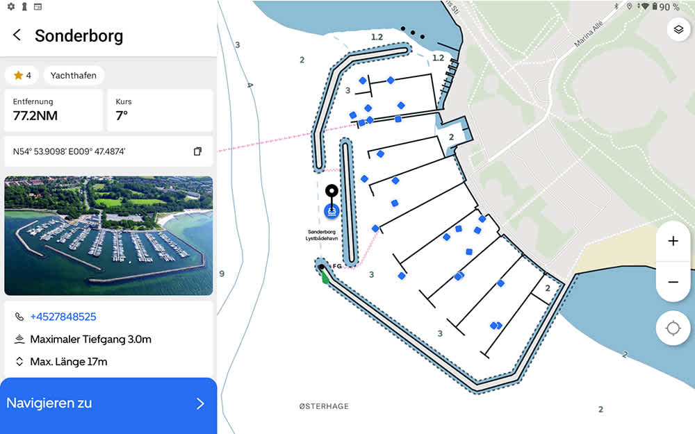
Example: Information about the harbor of Sonderborg, Denmark, has been accessed. ©Orca/BLAUWASSER.DE
Weather, wind, current, and tide information is also available. Orca selects the “best” source for the area. For example, wind data for the German North Sea coast comes from the DWD’s ICON model.
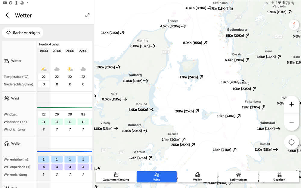
Example of a weather forecast for the Kattegat. ©Orca/BLAUWASSER.DE
Currently, these sources are used for weather data:
Germany: Deutscher Wetterdienst (DWD)
France and Southern Europe: Meteo France
UK: UK Met Office (UKMO)
Denmark: Forsvarets Center for Operativ Oceanografi (FCOO)
Finland: Finnish Meteorological Institute (FMI)
Norway: Meteorologisk Institutt
Sweden: Sveriges Meteorologiska och Hydrologiska Institut (SMHI)
Rest of the world: National Oceanic and Atmospheric Administration (NOAA)
Pricing
The individual components of the Orca system are priced as follows:
Orca Display: €999
Orca Core: €549
Orca Mount: €299
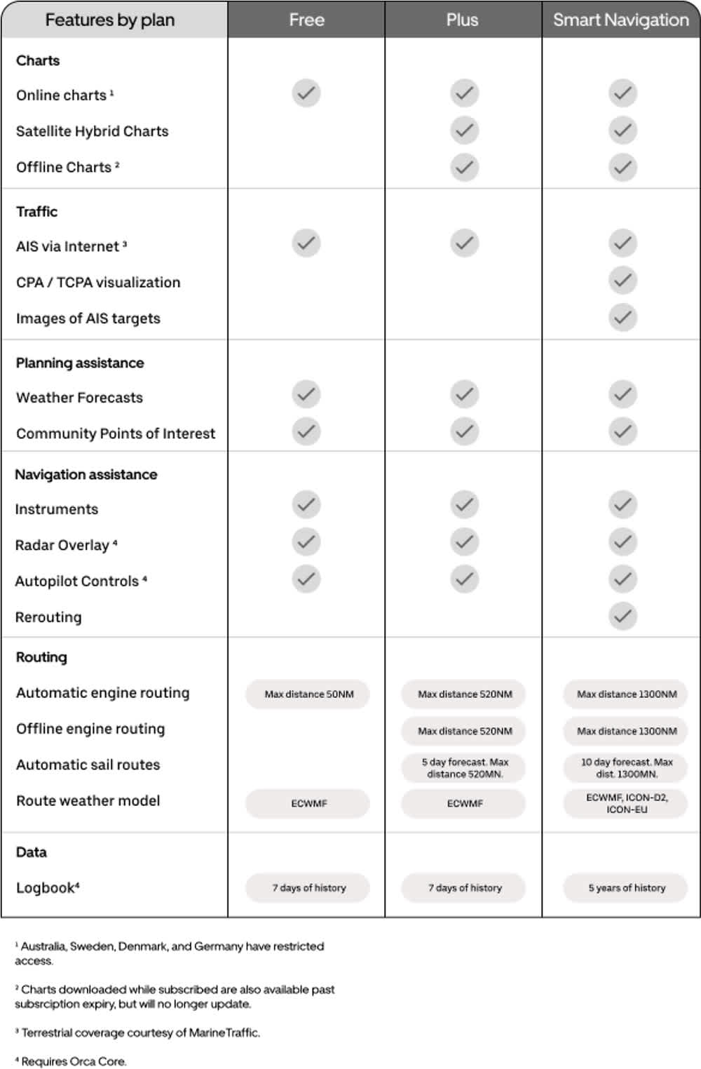
Full access to all features is free for the first year. After that, you can choose to continue with a basic free version or subscribe to one of two paid plans:
The “Plus” subscription costs €49/year and includes:
High-resolution online satellite imagery
Offline chart usage
Sail routing functions for five days
The “Smart Navigation” subscription costs €149/year and includes:
High-resolution online satellite imagery
Offline chart usage
Graphical CPA/TCPA display (AIS)
Additional AIS data, such as photos
Route recalculation
Sail routing functions for ten days
A detailed overview is available in the following graphic.
Conclusion
This extensive test, conducted over several weeks and passages, didn’t even cover all features. We even used the Orca Display to watch the Champions League final while anchored in the cockpit. While not its main use, it demonstrates the system’s remarkable versatility.
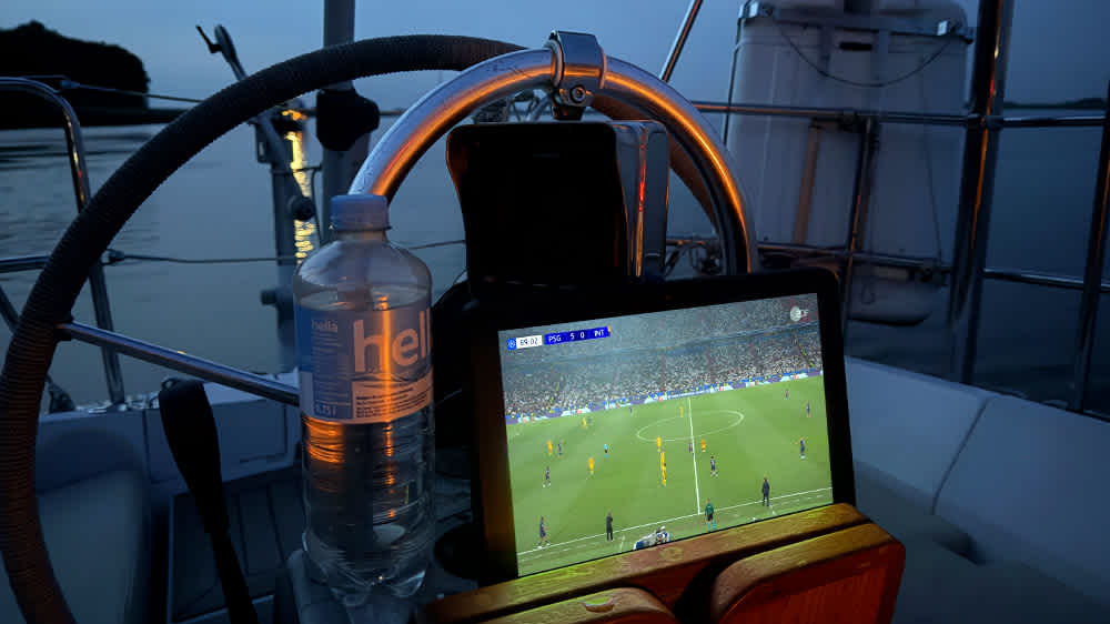
This is also one way to end the day with the Orca Display at anchor. ©Sönke Roever
One thing is clear: the Orca team have done an outstanding job, combining the strengths of chartplotters with those of smartphones and tablets. The result is a navigation solution with an impressive range of features. Once you start using it, it’s hard to let go.
For me, the real highlight is the combination of Orca Display, Orca Mount, and Orca Core. The sophisticated features of Orca Core, especially with polar data and route planning with weather routing, make the system truly complete. While some aspects are still a bit basic, I am confident we will see much more in the coming years.
In summary, Orca offers a comprehensive package with well-thought-out features for safe navigation onboard. I am fully convinced. I won’t be returning my system to the manufacturer; instead, I’ll be taking it with me — whether chartering, cruising, or crossing oceans.
For more information, visit the Orca website.

